Наверх


рус  укр  eng
Ecuador
  
Countries
  • Albania
  • Andorra
  • Austria
  • Belgium
  • Chile
  • China
  • Croatia
  • Cyprus
  • Czech Republic
  • Denmark
  • Ecuador
  • Estonia
  • Finland
  • France
  • Georgia
  • Germany
  • Greece
  • Italy
  • Jordan
  • Latvia
  • Lithuania
  • Luxembourg
  • Malaysia
  • Malta
  • Monaco
  • Montenegro
  • Netherlands
  • North Macedonia
  • Norway
  • Peru
  • Poland
  • Portugal
  • Romania
  • San Marino
  • Singapore
  • Slovakia
  • Slovenia
  • Spain
  • Sri Lanka
  • Sweden
  • Switzerland
  • Tanzania
  • Turkey
  • UAE
  • Ukraine
  • Vatican
Search
Ecuador > Galápagos > Sierra Negra Volcano (Isabela Island)

Sierra Negra Volcano (Isabela Island)

S 0°48.716', W 91°5.242'
2014-04-19
http://www.galapagospark.org/sitio.php?page=volcan_sierra_negra_chico
Our rating: 7.60
Overall rating:

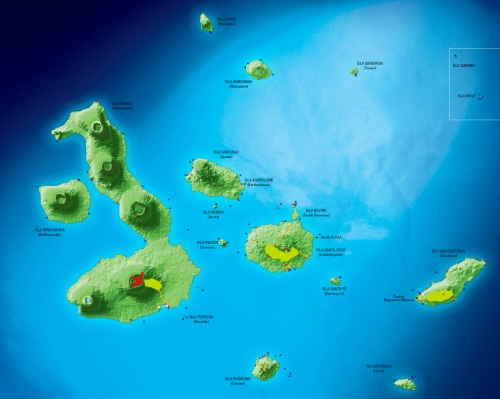
The Galapagos Islands have resulted from volcanic activity. If you look at the islands from the top, volcanoes are visible everywhere. The largest is Sierra Negra which is marked.

Map of the Galapagos Islands
Map of the Galapagos Islands ©galapagospark.org

There were more than 50 volcanic eruptions in the past 200 years on Galapagos Islands, local volcanoes are among the most active in the world. The most active, Sierra Negra, can be visited. At first you go up to the observation deck and watch the crater. Before visiting the volcano, we did not collect any information and had no idea what we will see. But when we saw the crater, we were a bit shocked.

Sierra Negra Volcano crater (Isabela Island)
Sierra Negra Volcano crater (Isabela Island) ©Yuriy Buriak

The crater has a distinct shape, its dimensions are 7.2 x 9.3 km and it is the second largest active crater in the world! Viewing point can be reached in one hour and then you can decide - walk futher or return. If you decide to go to the end, be sure to take a lot of water with you, as you will go under the sun for more then 5 hours. We also burned a bit, so that don't forget sunblock.

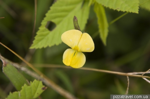
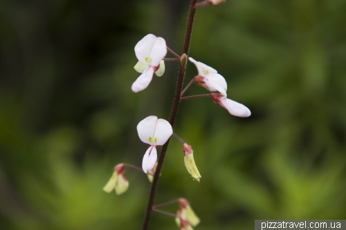
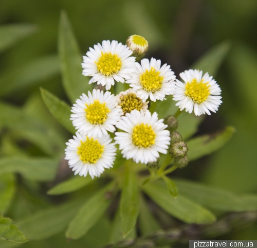
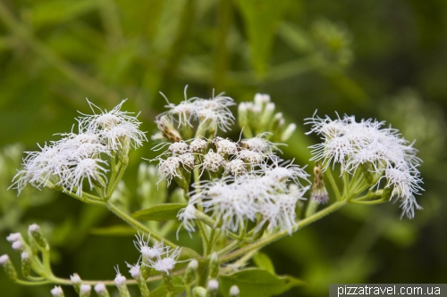
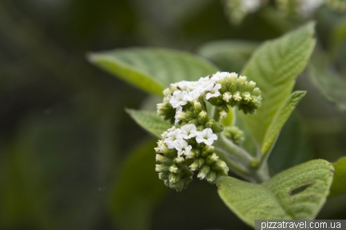
Trail goes along the edge of the crater, you will see the beautiful scenery throughout the trip. Curiously, around quite a lot of vegetation, I would even say too much vegetation for the crater. Almost all the flowers are local, that means they are white or yellow.

Vegetation on the Sierra Negra volcano
Vegetation on the Sierra Negra volcano ©Yuriy Buriak


Vegetation on the Sierra Negra volcano
Vegetation on the Sierra Negra volcano ©Yuriy Buriak


Vegetation on the Sierra Negra volcano
Vegetation on the Sierra Negra volcano ©Yuriy Buriak


Vegetation on the Sierra Negra volcano
Vegetation on the Sierra Negra volcano ©Yuriy Buriak


Vegetation on the Sierra Negra volcano
Vegetation on the Sierra Negra volcano ©Yuriy Buriak


Vegetation on the Sierra Negra volcano
Vegetation on the Sierra Negra volcano ©Yuriy Buriak

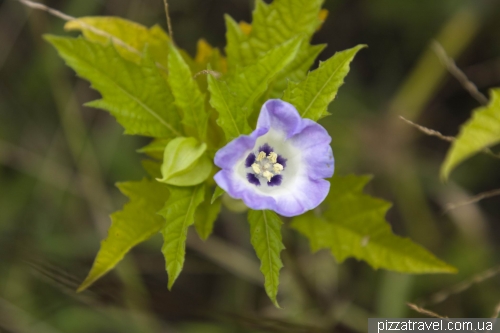
This one is not local

Vegetation on the Sierra Negra volcano
Vegetation on the Sierra Negra volcano ©Yuriy Buriak

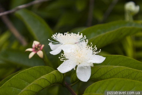
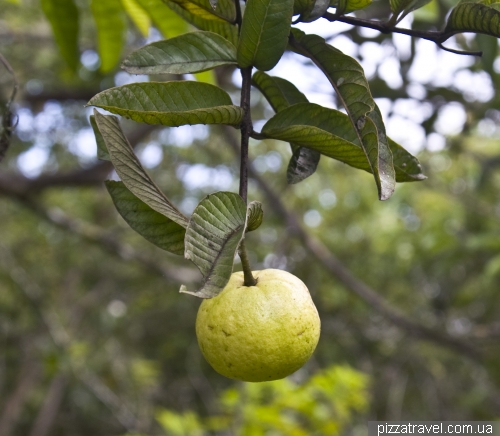
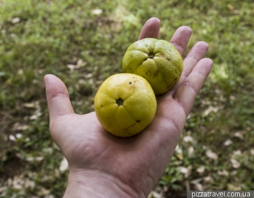
Around there are a lot of guava trees, we ate several guava fruits.

Guava
Guava ©Yuriy Buriak


Guava
Guava ©Yuriy Buriak

You have to go first to the parking place for horses. Those who ride on the horses stop here and continue on foot. From here the road turns right and goes down till the end. There is only one place for the rest on the whole trail, under the huge tree.

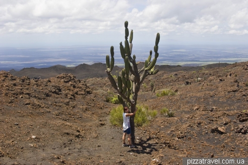
Next part of the trail is the most difficult. We went to Chico Volcano, which is actually so small, that looks like a part of Sierra Negra. Vegetation disappears, perhaps with the exception of a lone and colorful cactus.

Sierra Negra Volcano (Isabela Island)
Sierra Negra Volcano (Isabela Island) ©Yuriy Buriak

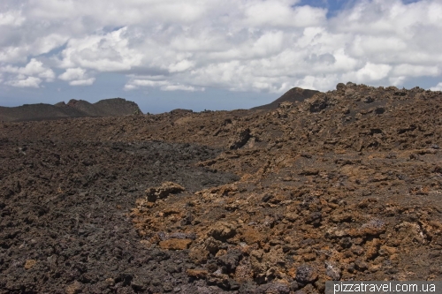
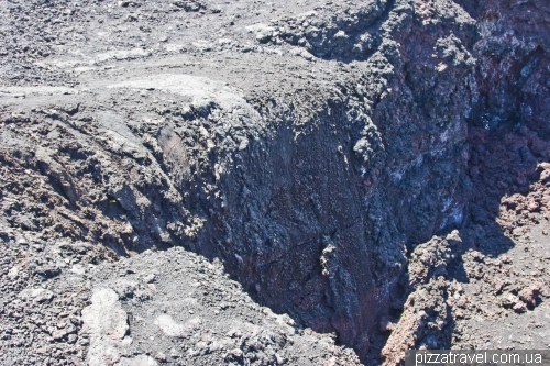
Around will be only lava. Sierra Negra volcano erupted in 1911, 1948, 1953, 1954, 1957, 1963, 1979 and 2005. On the next picture you can see lava of the two last eruptions.

Lava of eruptions in 1979 and 2005
Lava of eruptions in 1979 and 2005 ©Yuriy Buriak

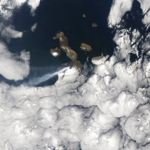
NASA has a picture from space of the last eruption (2005).

Eruption of Sierra Negra, 2005-10-25
Eruption of Sierra Negra, 2005-10-25 ©earthobservatory.nasa.gov

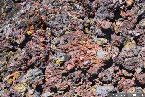
Lava looks pretty interesting and colorful.

Sierra Chico (Isabela Island)
Sierra Chico (Isabela Island) ©Yuriy Buriak

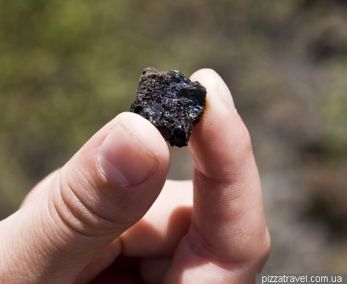
Lava stone is used for many purposes in Ecuador, for example for building houses and even churches, restaurants use it to cook dishes and the small stone on the next picture is used for jewelry.

Volcanic stone used for the production of imitation jewelery
Volcanic stone used for the production of imitation jewelery ©Yuriy Buriak

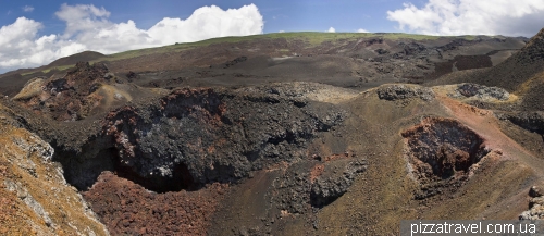
Here we saw large lava tunnels, lava rivers and lakes, and even lava waterfall.

Lava Falls
Lava Falls ©Yuriy Buriak

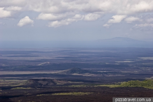
At the end of the route you will find a breathtaking view of the island of Isabella. In the distance can be seen other volcanoes and even the islands of Fernandina and Santiago.

Sierra Chico (Isabela Island)
Sierra Chico (Isabela Island) ©Yuriy Buriak


View of the Isabella island
View of the Isabella island ©Yuriy Buriak


View of the Isabella island
View of the Isabella island ©Yuriy Buriak


Sierra Negra Volcano (Isabela Island)
Sierra Negra Volcano (Isabela Island) ©Yuriy Buriak

Getting there: visit to this volcano is included in many cruises. There are also guided tours from the village of Puerto Villamil ($35). If you want to visit it alone, then come by taxi to the start of the trail (the place with toilets and small cafe) and talk to driver regarding the return trip.
Tags, Ecuador: galapagos, stroll, volcano

Tags, all countries: galapagos, stroll, volcano
- Rate this place -
Location :

Impressions :

Number of tourists (weekend afternoon) :

State :

Picturesque (for the photographer) :

* - Note: Description of the evaluation is not always appropriate for a particular object, it's just a little help
Our rating - 7.60
Location :

Impressions :

Number of tourists (weekend afternoon) :

State :

Picturesque (for the photographer) :

* - Note: Description of the evaluation is not always appropriate for a particular object, it's just a little help
Visitor's rating - 0.00
Location :

Impressions :

Number of tourists (weekend afternoon) :

State :

Picturesque (for the photographer) :

* - Note: Description of the evaluation is not always appropriate for a particular object, it's just a little help
Please follow standard rules to add comments

Name / Nickname


You can also log in with your name or with social networks

Comment

  - What you need to see (18)
  - What to see next (8)
  - Other interesting places or events (6)
View map
  - Azuay (0)
  - Bolivar (0)
  - Cañar (0)
  - Carchi (0)
  - Chimborazo (0)
  - Cotopaxi (3)
  - El Oro (0)
  - Esmeraldas (0)
  - Galápagos (16)
  - Guayas (0)
  - Imbabura (0)
  - Loja (0)
  - Los Ríos (0)
  - Manabí (0)
  - Morona-Santiago (0)
  - Napo (5)
  - Orellana (0)
  - Pastaza (0)
  - Pichincha (4)
  - Santa Elena (0)
  - Santo Domingo de los Tsáchilas (0)
  - Sucumbíos (0)
  - Tungurahua (4)
  - Zamora-Chinchipe (0)

Puerto Villamil (Isabela Island)

21.13 km

Las Tintoreras (Isabela Island)

22.61 km

Elizabeth Bay

23.93 km

Punta Moreno (Isabela Island)

29.03 km

Urbina Bay (Isabela Island)

48.85 km

animals beach city galapagos height hotel island lake mountains observation deck park river sea ski lift stroll unusual buildings unusual structures volcano waterfall zoo
2024-10-04 19:07
Kaminne Selo (Stone Village)
2024-09-25 00:20
The most expensive real estate in the world at Cap Ferrat
2024-06-18 21:40
Greece
2024-05-09 10:38
15 best parks of Ukraine
2024-03-08 21:08
France
Mount Zugspitze - 10
Goreme National Park - 9
Observation Deck on the Chervonozorianyi Avenue - 1
Potsdam - 8
Sigulda, Krimulda and Turaida - 8
About Us
Advertising
List of countries
Travel history
© 2012 - 2024
PIZZATRAVEL.COM.UA
Unauthorized use and/or duplication of this material without express and written permission from this site’s author and/or owner is strictly prohibited