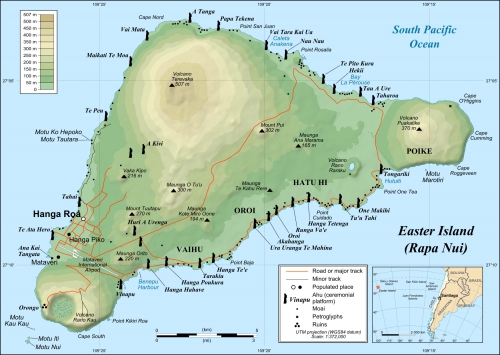
The nearest inhabited island is located 2075 kilometers from Easter Island and the distance to the coast of South America is 3500 kilometers. We are too small and for us it's hard to realize such distances.
Such places are always interesting for historians or science fiction writers, since a completely different culture had been developing here for centuries. This can be compared to the discovery of a new populated planet.
For me it is absolutely not clear how people could get to this island before Easter Sunday, 1722, when the Dutch seafarers found it. According to the DNA tests, it is already known that the inhabitants of the island arrived probably from Taiwan. Although it is unknown when it happened, it is believed that around 1200 CE. Just imagine, before the big ships, before sextants, before maps, some group of people got into boats and sailed to nowhere. After thousands and thousands of kilometers they found a small island in the ocean. It sounds incredible, but it's for real.
There were forests on the island, birds and an excellent climate. With such favorable conditions the society began to develop rapidly and gradually reached the construction of large stone statues (moai, ahu, aku). Probably they were the images of ancestors.
The population grew and all the forests disappeared (approximately in 1600). No forests - no materials. Ordinary life was threatened, it was impossible to build houses, make new statues and boats. The population began to fight with each other and its number decreased. At the time of arrival of the first Europeans, there were only 2-3 thousand of Rapanui people, although 100 years ago there were 15 thousand of them. In the middle of the 19th century came slave traders from Peru and Bolivia, who began to export the locals to the continent. The Rapa-Nui civilization disappeared.
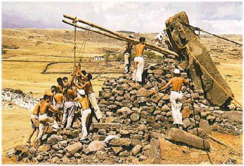
For a long time it was not clear how exactly the statues moved from the quarry all over the island. It is logical to assume that with the help of rolling logs. The first who decided to explore this was the famous Norwegian traveler Thor Heyerdahl. In 1955-1956 he organized an expedition to Easter Island in order to study the history of the Rapanui people and determine how the statues were made and moved.
After the expedition he wrote the book "Aku-Aku: the Secret of Easter Island" (1958), which opened the island to the world. As it turned out, the statues literally walked around the island. In the future, this technology was repeated many times, that's how it looked (youtube).
When to go to the Easter Island
The weather is approximately the same throughout the year and is quite good. Slightly warmer in January (+23), slightly colder in June (+18). It is better to come in the summer months (for the southern hemisphere): November - March. During the day the weather changes every hour, at least so it was in March.
Getting to the Easter Island
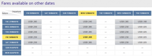
The only option is a LATAM airplane from Santiago. Tickets are dismantled very quickly and usually not available for the nearest weeks. And this is despite the fact that the prices are very high. When we first saw them, we did not even believe, thought that currency is wrong. See for yourself, now is November and prices are for the end of March.
Yes, these are prices per person! In the past it was possible to buy cheaper tickets through the Chilean version of the LATAM website, and we bought tickets for $600.
Therefore you will have to plan your entire trip to Chile, taking into account tickets to Easter Island. Play with skyscanner and the LATAM website (https://www.latam.com/en_un/), try to find the cheapest dates.
What to do on the Easter Island
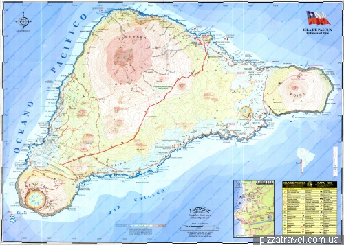
The island is small, but you cannot visit all the places on foot. A taxi for a day will cost $100. An inexpensive car is about $60 a day, scooter - $30, bicycle - $15.
Despite the fact that there is no public transport, there is a Hop on - Hop off bus, which is called "Ara Moai". Find here schedule, map and prices.
You can also use the travel agencies, find them on the central street:
https://www.easterisland.travel/
http://akuakuturismo.cl/en/
http://www.gitourseasterisland.com/en
http://www.mahinatur.cl
http://www.rapanuitravel.com/
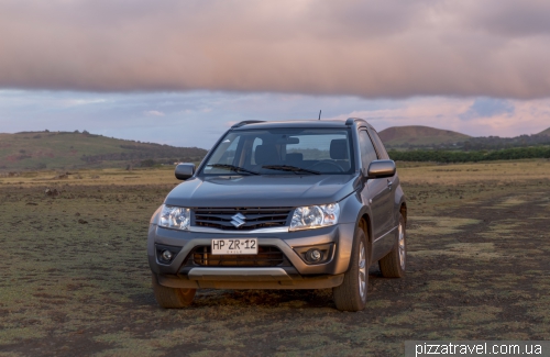
We booked a car via the Internet. It's more expensive, but may be a good idea since there are not so many cars on the island. We took automatic Suzuki Grand Vitara (http://www.rentainsular.cl/. Note that there is no insurance on the island (even for locals), so drive carefully.
There is only one gas station (S 27 09.376 W 109 26.079) with no prices for the fuel, since there is only ONE :) The main roads are asphalted, but there can be quite large pits (2017), as well as cows or horses.
Where to sleep on the Easter Island
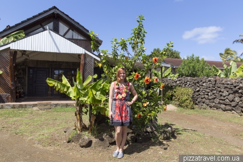
There is enough housing and it is quite inexpensive, many budget options can be found for $70-80. We searched for a room with a kitchen and stayed at Te Ngahu Bungalows (Cabañas Ngahu, booking.com). The location is good (S 27 08.972 W 109 25.929) and there is a small parking lot.
The hostess met us at the airport and gave fresh flowers, this is a tradition.
Internet and mobile communication on the Easter Island
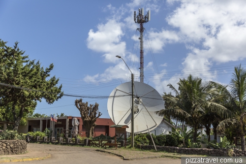
Only satellite internet and very slow. In some places in the village there are points of free Wi-Fi ChileGob. Mobile communication is only in the village. In 2017 it appeared around Rano Raraku, soon expected near the Anakena beach. In any case, it is not very good.
Prices on the Easter Island
The prices for food are very high, about 3-4 times higher than on the mainland. I remember the 2-liter package of juice for $15. We brought some food from Santiago, as there was a kitchen in the house.
What to see on the Easter Island
Two and a half days was quite enough to visit everything we wanted. Some locations even for several times. Upon arrival, buy a ticket at the airport, it costs about $60 (2017) and allows you to visit the most interesting places. Many locations can be visited for free.
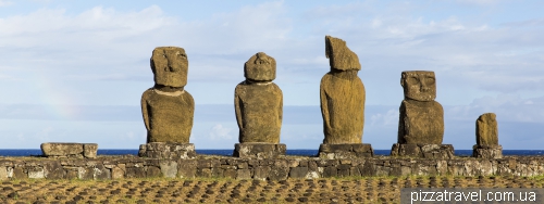
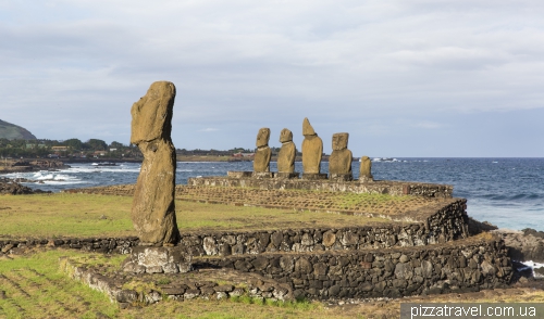
Ahu Tahai and Ahu Ko Te Riku (parking S 27 08.519 W 109 25.610, free of charge)
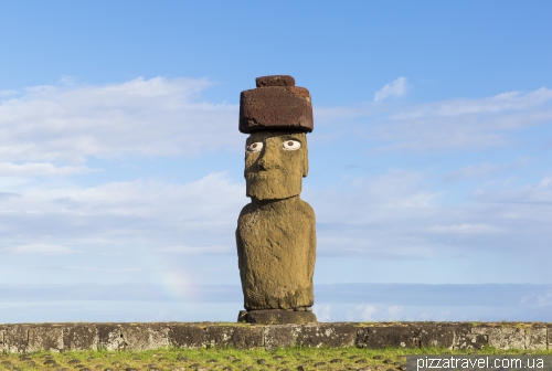
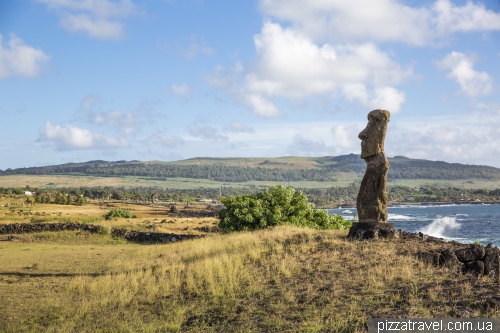
The most popular moai statues, as they are located in the village. The statue of Ahu Ko Te Riku is especially popular with tourists, as it has restored eyes.
The complex was restored by the American archaeologist William Mulloy. His ashes was interred here under one of the stones in the southern part of the platform. Please, don't search for it :)
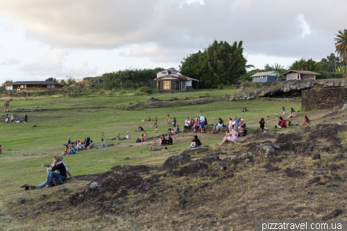
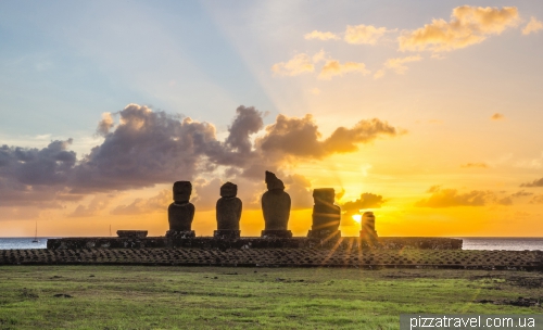
In the evening many tourists come here to meet the sunset. The place is very comfortable.
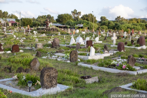
If you go to Ahu Tahai on foot, you will see also a traditional cemetery (S 27 08.586 W 109 25.650).
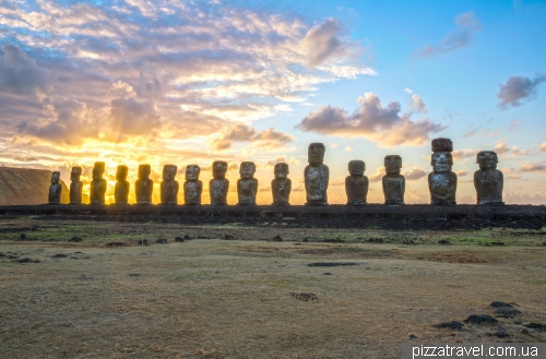
Ahu Tongariki (parking S 27 07.616 W 109 16.691, ticket)
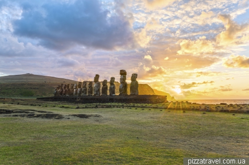
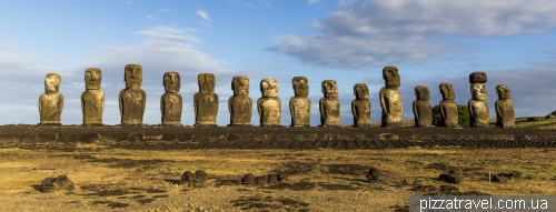
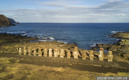
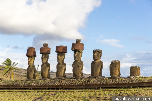
The most famous place on the island. On the ceremonial platform here stand 15 statues and some of them are really huge. For example, a statue with a hat (pukao) has 14 meters in height.
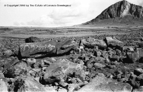
In 1960 near the coast of Chile there was a strongest earthquake in history with a magnitude of 9.5. 11-meters tsunami flew to Easter Island and demolished the statues, throwing statues 100 meters from the platform.
In 1996 restoration works were carried out. They were financed by the Japanese company Tadano, which managed to deliver a large crane to the island. This was not so easy, since there is no port.
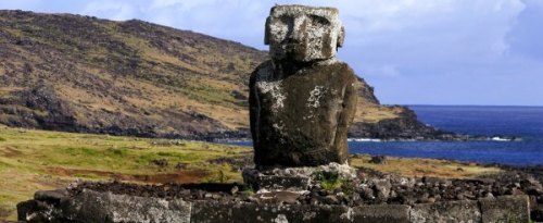
Near the entrance to the Ahu Tongariki platform stands another lonely moai. This is the statue which was used by Tour Heyerdahl for "walking" experiments. In 1982 it was sent to an exhibition in Osaka (Japan) and after that received the nickname "traveler".
We came here two times, first at dawn, when there were quite a lot of people.
And closer to the evening, when the sun is on the other side.
Rano Raraku (parking S 27 07.617 W 109 17.519, ticket)
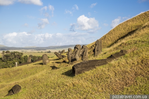
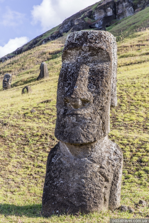
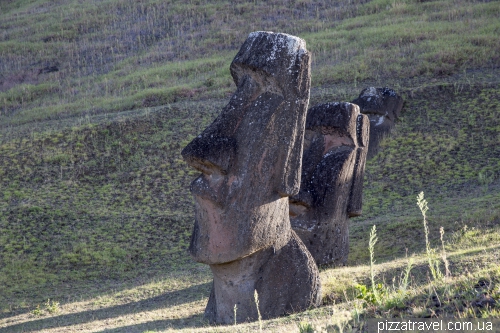
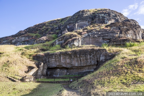
The volcano and the quarry, a very unusual and interesting place, worth a visit. Here the famous moai statues were sculpted from the rocks. Hundreds of them are either unfinished or not transferred to platforms.
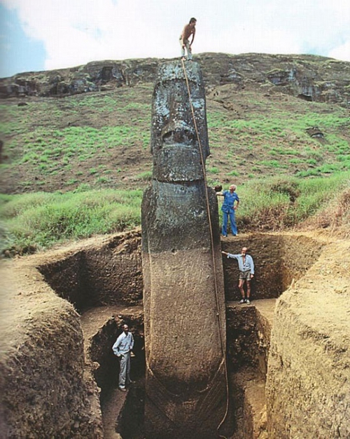
Basically you will see only the heads of the statues, since the body is hidden under the ground. Total height reaches 13 meters.
One of the unfinished moai has a length of 21 meters and weight of 200 tons! The Rapanui people made bigger and bigger statues and at some point exhausted all the resources of the island.
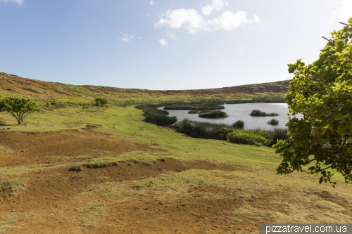
You can also get to the crater of the volcano. Although it is not particularly interesting, you can search for unfinished moai there.
Ana Kai Tangata cave (parking S 27 09.726 W 109 26.447, free of change)
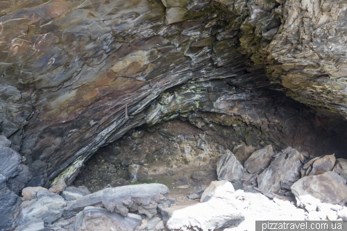
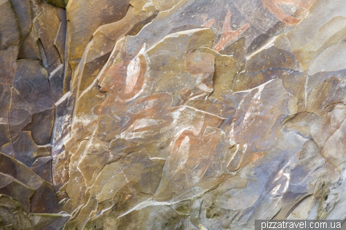
The volcanic cave with the images of the bird-man. The place is beautiful and even dangerous due to the waves.
Orongo (parking S 27 11.167 W 109 26.595, ticket)
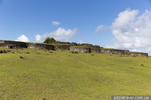
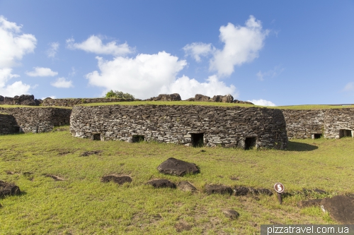
Ceremonial village, which is located in an extremely picturesque place. There were held various rituals, for example, children entered adult life.
In Orongo there is a famous petroglyph of the bird-man, which became the second symbol of Easter Island, after moai.
It is believed that he personified the desire of people to leave the island and see other lands, about which they heard in legends from their ancestors. Here also the Bird-Man Tournament was held, the purpose of which was to find the first manutara bird egg (the local seagull) on the nearest rocky island of Motu Nui.
Unfortunately, the first tourists who came to the island in the 70's, freely entered the reconstructed rooms and took stones with drawings, like souvenirs!
Vinapu (parking S 27 10.528 W 109 24.415, ticket)
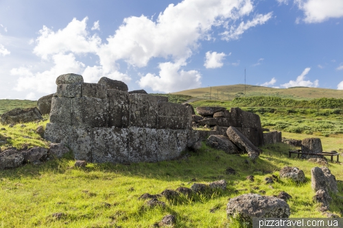
A unique place. It became the main evidence that in the 1480s an Inca fleet arrived on the island. It is believed that the Inca Empire had balsa rafts on which they traveled long distances and reached even the Easter Island. Just think, the Incas, using rafts, made trips comparable in distance with the journey of Columbus, who sailed on the three most modern ships of that time. And they did this earlier.
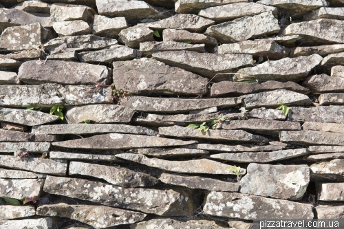
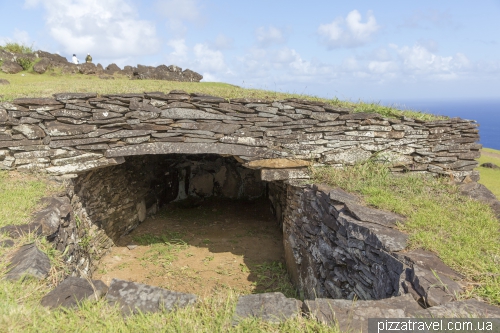
The Incas built a small temple on the Easter Island, using their traditional and well-known masonry of basalt blocks. Compare it with Orongo.
Unfortunately the temple looks ruined. In 1886 the crew of the USS Mohican (USA) blew it up to see if there is anything interesting down there.
Volcano Rano Kau (free of charge)
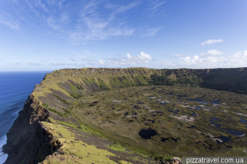
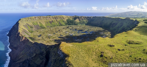
Almost everyone is watching a volcano crater from the viewpoint near the ceremonial village of Orongo. We decided to look at it from the other side. As it turned out, this place is much more beautiful.
You can get there as follows. Turn from the road to Orongo here S 27 10.686 W 109 25.597, this place is reachable by foot, bike or scooter. You can also park there. Then walk along the dirt road, it is impossible to get lost. The end point is here S 27 11.592 W 109 25.966. If you go on foot from Hanga Roa, then the total one-way route is about 7 kilometers (90 minutes).
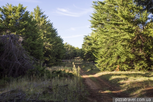
Around 1600 the Rapanui people used all the wood for the production and transportation of statues. Over the past 30-40 years forests have grown again and you will see one of them.
And the final view
From the drone
Anakena beach and Ahu Nau Nau (parking S 27 04.471 W 109 19.480, free of charge)
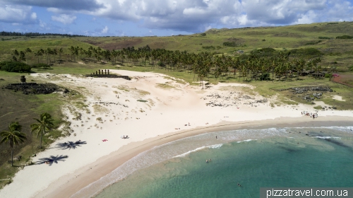
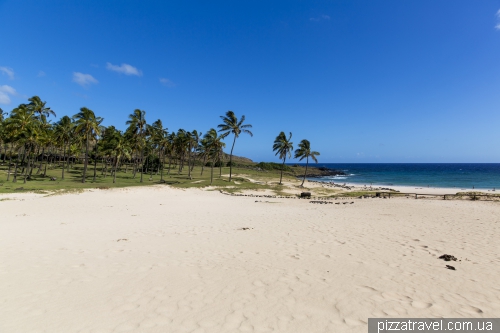
Anakena is the only sandy beach on the island. It looks like a real paradise beach: white coral sand, azure water and palm trees. The water temperature is about 20 degrees year-round. In March, before lunch, the beach is absolutely empty. In high season there are quite a lot of people here.
There is a restaurant on the beach, the prices are quite high, but the food is delicious. You can also arrange a picnic under the palm trees.
The beach is located 18 kilometers from the village of Hanga Roa. The taxi will cost $30, just agree the return trip in case mobile networks will be not available. You can also come by bike, the distance is suitable for a day trip.
Palms were brought from the island of Tahiti.
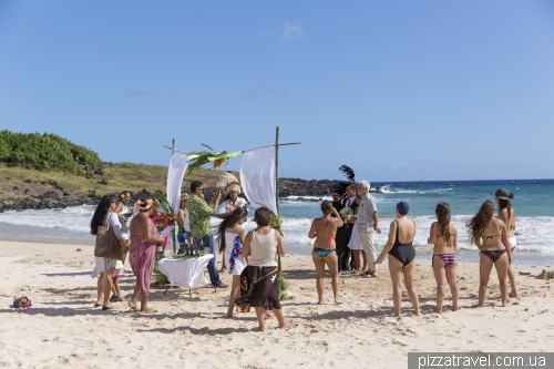
Traditional wedding
Anakena Beach is also a historical landmark of the island. The first King of Rapanui, Ariki Hotu Matu, landed here. There are few moai on the beach. Ahu Ature Huki is the first restored statue.
It was raised by the locals at the request of Thor Heyerdahl in 1956. He wanted to test the theory that statues can be easily lifted using sticks and ropes.
Ahu Nau Nau is a large platform with seven moai that was rebuilt in 1978. These are the most preserved statues on the island, due to the fact that they have been under the sand for centuries.
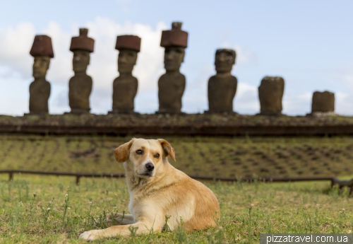
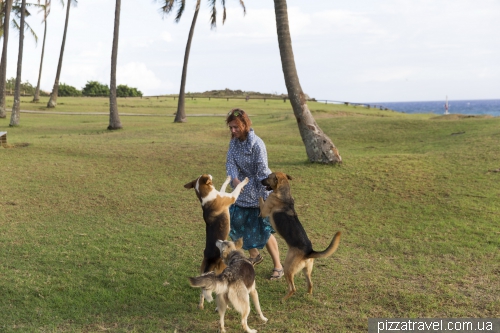
Few homeless dogs live on the beach, they are friendly.
Chimango Caracara, a bird from the family of hawks.
Ahu Akivi (parking S 27 06.936 W 109 23.717, free of charge)
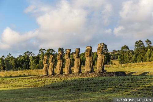
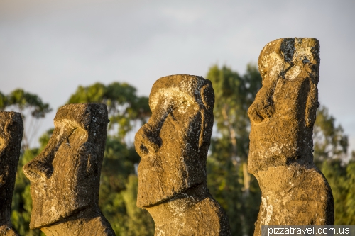
This platform is interesting as it is located in the middle of the island, while others are on the shore. We drove in here in the evening, when the sun perfectly illuminates the statues.
Here also the start of a hiking route to the Terevaka volcano (8 km, 4 hours), the highest point of the island.
A viewpoint at Mataveri Airport (somewhere here S 27 10.057 W 109 25.111, free of charge)
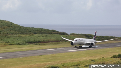
The airport on the island was built in 1967 and the tourism industry began to develop. In 1987 the US agreed with Chile to extend the aerodrome strip by 423 meters, which made it suitable for an emergency landing of the space shuttle.
Find out in advance the schedule and come to the road over the airport. It offers an excellent view of the landing of the modern Boeing 787 Dreamliner, which now (2017) flies from Santiago once a day.
Hanga Kioe statue (S 27 08.001 W 109 25.634, free of charge)
One of the later statues, established in the 17th century. It is located a little further along the beach then Ahu Tahai, we walked there.
Pu o Hiro (S 27 05.640 W 109 16.898, free of charge)
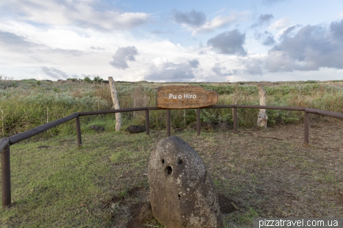
Just a stone near the road, the ancient god of rain. Due to the presence of several holes, it is considered a musical instrument of the Rapanui people.
There is a great movie about the island: "Rapa Nui: The Lost Paradise" (1994). Of course it does not fully correspond to historical events, but the island itself and moai culture are shown very well, we recommend.
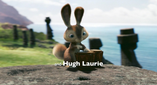
And in the end, we disappoint those who want to see a cute rabbit from the cartoon "Hop" (2011). There are no rabbits, only lizards.
